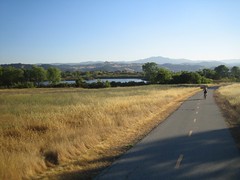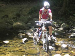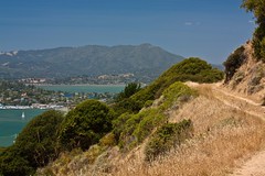
Sunday we took our bikes to Angel Island for a ride just under 10 miles long. We left early morning to drive to Tiburon and then caught the ferry to the island.
We took the perimeter (paved) road around clockwise so we could hop onto the inner road early in the trip. It was a decent climb to a dirt fire road that loops around the inner part of the island. After completing that loop we dropped back down to the perimeter road and completed that.
This is easily one of the most scenic bike rides I've done. No matter where you were on the trail there was a view of the bay. The weather was perfect. It was a great day. There was a few tourists there but they all pretty much stayed on the perimeter road.
We took our time on the trails and took a ton of photos. By the time we got back to Tiburon the tourist rush was gone and getting a shady patio seat at a restaurant there was extremely easy.
Click for Route:
Friday, June 26, 2009
Friday, June 19, 2009
Coyote Creek Parkway: Uphill both ways.
In an effort to get out during the week, we attempted the Coyote Creek trail after work last night. This time we went a total of 25.5 miles. Still 5 miles (round trip) short of the end, but we had to make it back by sunset. The return trip should have been a slight downhill but with a head wind it actually took off almost 2 mph, making it feel as if it was uphill in both directions.
It's a nice parkway with lots of shade. The new parts for us were mostly in old ranch land and preserved areas and very pretty. There are even rest stops along the way. We made use of one just after turning around so we could get a bite to eat. The only thing that would make this trail better is if it was single track :).
Click for Route:
Sunday, June 14, 2009
Waddell Creek: Revisited
I said I would go back to Waddell Creek and today I did :). This time we had plenty of time to do the whole trail. It's a fun track, very shady, and the creek is always nearby. An awesome area.
There are no long uphills or downhills and nothing too technical. There are some short steep sections that are challenging to climb and a blast to go down, but any of them can be walked up or down depending on skill level. The creek was a little high, but fordable. Although you can walk your bike on a footbridge if it wasn't.
It was a great and sunny day. The trailhead is at the coast (see previous blog entry about the area) so we planned on a beach picnic at the end of our 11.8 mile (round trip) workout. JalapeƱo cheddar sandwiches on the beach make for a nice reward :).
My GPS is on it's last breath it seems. The X-axis on the stick no longer functions, making it extremely difficult to navigate the menus (and impossible to save and then start a new track). So a new GPS may be in order.
The large redwoods and other trees made it really difficult to get an accurate GPS track, but I uploaded it anyways.
Click for Route:
Sunday, June 7, 2009
Muddy Buddy (updated)
Donna and I did Muddy Buddy today as "Team Chewy". It was a pretty fun running and mountain bike biathlon/obstacle course. First leg was just a grueling uphill for me on the bike and made for a miserable run on the second leg, but things picked up from there. Highlights were the cargo net climb up to the inflatable slide, the fast–but dangerous apparently, there was a guy on a stretcher–downhill on leg 3, and of course the mud pit at the end.
Didn't bring the camera but did get a photo of my bathtub during cleanup :). Hopefully they post results and more photos soon.
Update 6/11: Here's a photo from the event:
Didn't bring the camera but did get a photo of my bathtub during cleanup :). Hopefully they post results and more photos soon.
Update 6/11: Here's a photo from the event:
Wednesday, June 3, 2009
Fanime 09
Over memorial day weekend I took about 400 photos at Fanime. Mostly Lolita fashion related. It took me a while but I finally got around to sorting through them and finding some of my favorites. I violated quite a few rules of photography, but it was a learning experience =P
Here are some highlights but there are a few more on my flickr page:
Subscribe to:
Posts (Atom)