Been pretty rainy here which has been ruining some of my trip chances. We made it to Arastadero two weeks ago but it was pretty uneventful other than my girlfriend's first real off-pavement adventure. It was a short trip (4-5 miles) but good experience for Donna.
This week I decided to go to Quiksilver Alamaden State Park which is fairly close to home in the hills south of San Jose. Back in February I had attempted to bike here but it ended in embarrassment. The problem with Quicksilver is to get to the trails you have to climb up a few hundred feet and I pushed myself too hard from the Mockingbird parking lot for the first ride of the year.
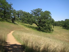
So I decided this time to start from the Hacienda parking lot and planned a loop route just over 11 miles long. It was a hot day and there is little shade so I was glad to get an early start.
The climb up was rough but not nearly as bad as the Mockingbird entrance or the Joseph D. Grant loop last month–which was just brutal. I told myself I would not get off the bike until a half-mile up and then as I hit the half-mile I realized I might be able to actually make it up. In the end it was a 1.25 mile 400 feet climb. Not a bad grade.
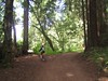
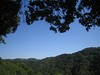
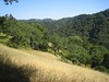
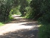
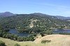
Once up into the park I took Randol Trail which was very nicely shaded–the only shade I got that day–and very flat. It was a much needed rest on the legs and an enjoyable trail. Just after 5 miles it joins the Mine Hill trail at Guadalupe Reservoir. I took a quick break here to take some photos and I could see to my left that I had a big climb ahead of me to the top of the park.
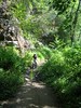
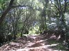
The Mine Hill trail goes up, and up, and up. Every time I looked down at my GPS to check the elevation I was sure I was near the top. At 1,300 feet I thought there couldn't be much more, but it turned into 1,400 feet which then turned into 1,500 feet, and finally as my legs turned to jelly I topped out at 1,650 feet on the Castillero trail. There was a bail-out a mile back or so if you keep following the Mine Hill trail, but I was committed to the track I drew.
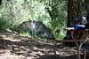
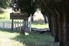
I took a break at the old Rotary Furnace for a few bites to eat. I was very glad to be done with climbing although I had mapped out a leg off the main loop that goes to an old cemetery, unfortunately: downhill. A glutton for punishment I decided to go through with it and ride the cemetery trail and as I went down I knew that was probably a mistake. The cemetery is old,and overgrown with no markings on any of the graves. It wasn't the photo-op I had hoped for (old cemeteries always look better in my head.)
Trying to get back up to the trail was just too much and I ended up walking the bike. My legs could stand no more. The remaining 2 miles back to the car took me only about 10 minutes of riding as I rocketed down and out of the park.
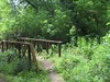
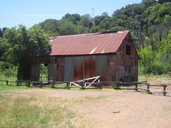
The fast, weaving downhill was a great reward for all the work. Check the GPSies link below for the elevation data, this route is mostly uphill and would be hell to try in reverse (although a long relaxing downhill would be fun.) Quicksilver would be a fun playground for bikes if it didn't have so much elevation change, there is only one flat trail in the whole park. It's littered with old mining structures and shafts which are cool to see.
Click for Route:

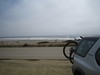
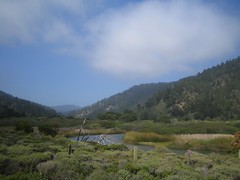 Monday we went to do some afternoon biking in Pescadero County Park but missed our turn-off and next thing you know we're out of the mountains and on the coast. So instead we went south along the coast until we got to Big Basin and did part of the skyline to the sea trail.